URBANLY
ACCELERATE GROUNDED, BETTER-INFORMED DECISIONS IN URBAN CONTEXTS.

EMPOWERING DECISION-MAKERS BY COMBINING EXPERT DOMAIN KNOWLEDGE WITH MODEL-BASED ALGORITHMS IN ORDER TO GENERATE A DEPENDABLE AND EVOLVING VISION THAT HELPS TO MAKE INFORMED DECISIONS.
Data Collection
Data Management & Analysis
Knowledge
Best Decisions
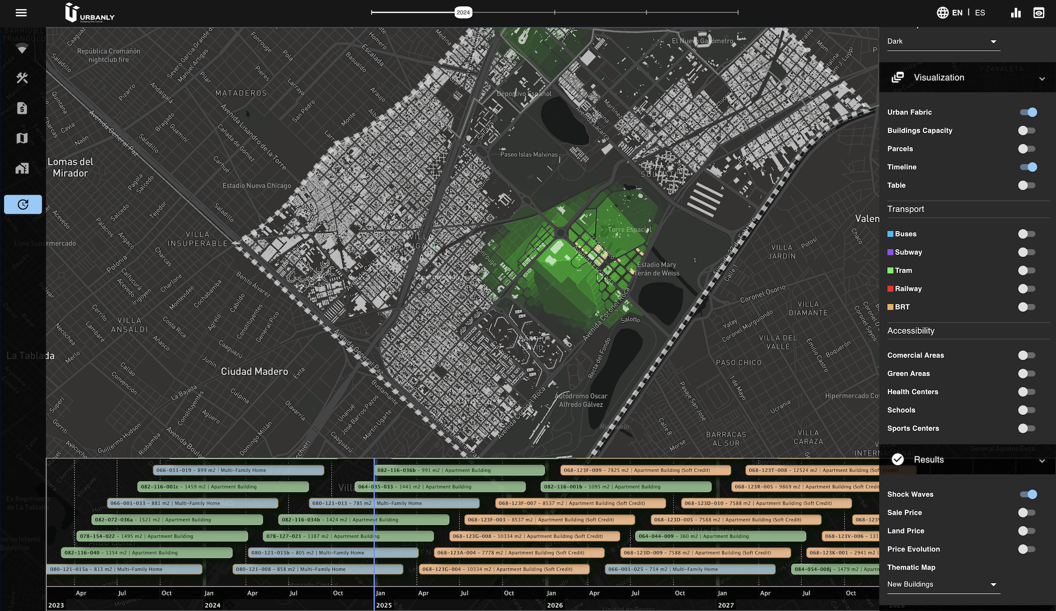
With CityCompass it is possible to analyze both present and future accessibility in real-time. Visualize the current transit lines for the different modes, add urban equipment in future years and see how accessibility indicators change, also affecting incentives for demand.
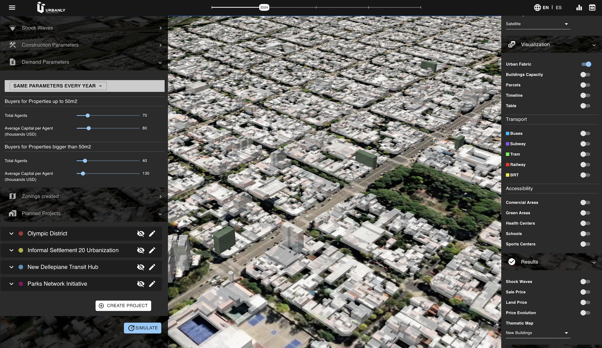
In CityCompass is possible to configure different sets of Real Estate Agents, targeting specific parcel sizes, building types and uses. The tool computes proformas for each agent and parcel of the study area in a few seconds. This information is then used for assessing the decisions of agents competing for the available land.
CityCompass allows the design of scenarios around a set of planned projects, that generate urban effects in their surroundings. The impact of each project could be precisely tuned by the user, and during simulation time will affect prices and incentives for offer and demand.
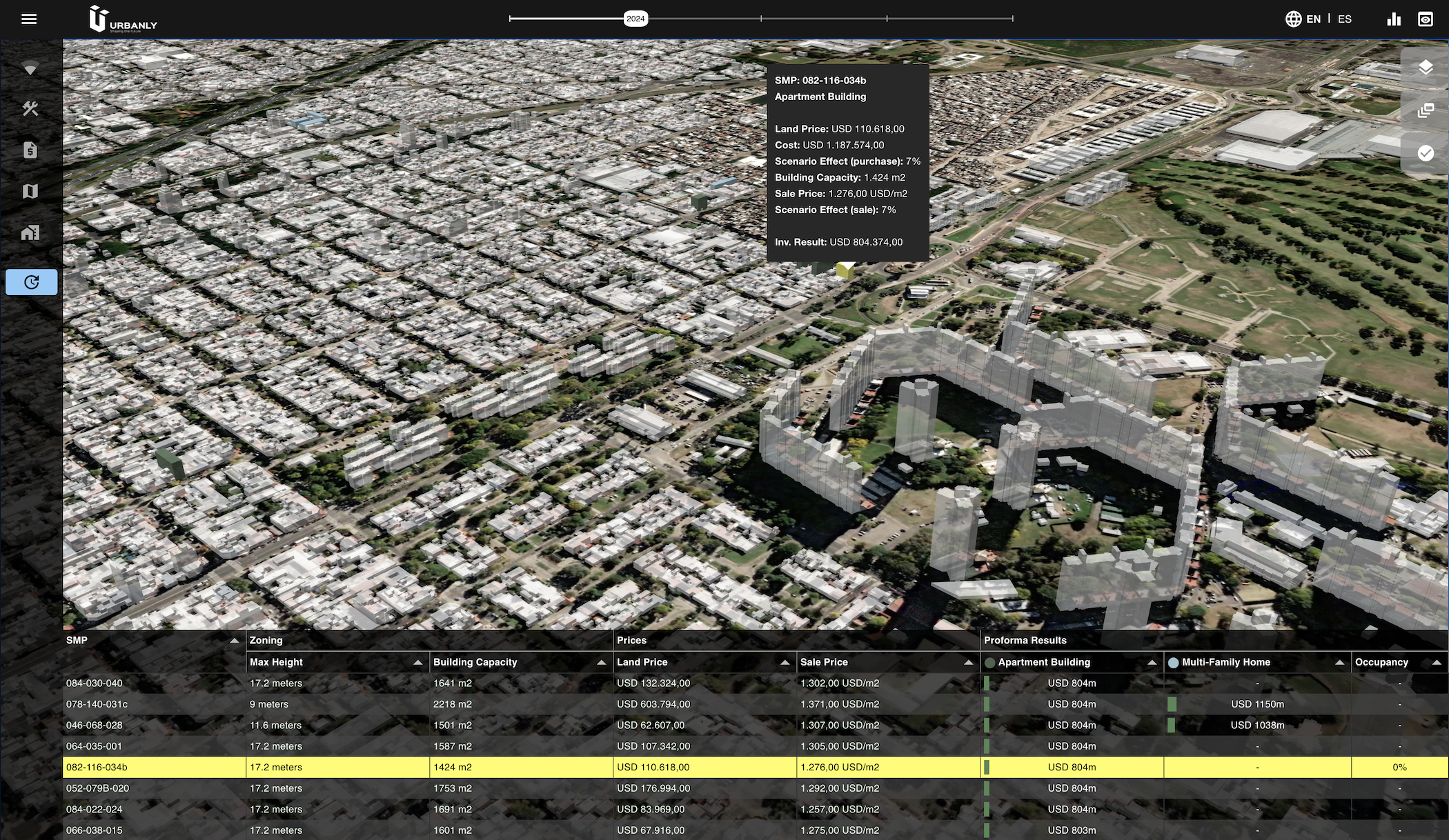
Underlying the CityCompass interface resides a powerful simulation engine that can discover interactions between agents that are very difficult to anticipate with just planning analysis. Each demand agent represent a particular household type, that will bid for available properties affecting how prices evolve over time.
URBANLY WAS CREATED MOTIVATED BY THE DESIRE TO LIVE IN COMMUNITIES DESIGNED FOR THE FUTURE AND PREPARED FOR GROWTH.
Using Opensource and proprietary tools we facilitate the task of decision makers by providing our experience in Data Management and analysis to convert them into specific indicators and, through algorithms based on models, generate future scenarios to make informed decisions.